Main navigationMain content
University of Minnesota
http://twin-cities.umn.edu/
612-625-5000
Go to the U of M home page
  • One Stop
  • MyU : For Students, Faculty, and Staff
  • About
    • Overview
    • Impact
    • People
    • Find Us
  • Data + Services
    • Overview
    • Maps
    • Satellite
    • Aerial
    • Elevation
    • ArcticDEM
    • REMA
    • Web Applications
    • Request
  • Community
  • Workshops
    • PGC Data
    • Antarctic Cable
  • Guides
  • Login
Skip to content

Hello! Login

Polar Geospatial Center Logo
  • Home
  • About
    • Overview
    • Impact
    • People
    • Find Us
    • Careers
  • Data + Services
    • Overview
    • Maps
    • Satellite
    • Aerial
    • Elevation
    • ArcticDEM
    • REMA
    • EarthDEM
    • Request
  • Community
    • News
    • Projects
    • Events
    • Workshops
    • Boot Camp
  • Web Apps
    • Fridge
    • Coordinate Converter
    • Mosaic Viewers
    • Map Catalog
    • ArcticDEM Explorer
    • REMA Explorer
    • ArcGIS Online
    • Antarctic TMA Viewer
    • COMNAP Dashboard
    • ICE-D
  • Guides
    • User Services
    • Commercial Imagery
    • Stereo Elevation Models
    • Web Mapping Applications
    • PGC Coding and Utilities
    • Miscellaneous

Tag: Elevation

New Access to PGC ArcticDEM and REMA

New Access to PGC ArcticDEM and REMA

Posted on March 6, 2025March 14, 2025Categories NewsTags ArcticDEM, Elevation, Public Data, REMA, STAC

PGC is pleased to announce a new way to access our public high-resolution polar elevation datasets: the PGC Dynamic STAC … Continue reading New Access to PGC ArcticDEM and REMA

ArcticDEM Mosaic 4.1 Release August 2023

ArcticDEM Mosaic 4.1 Release August 2023

Posted on August 17, 2023September 29, 2023Categories News, ProjectsTags ArcticDEM, Data Release, DEM, Elevation, Geospatial, GIS, remote sensing, Satellite Imagery

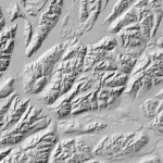
Revolutionizing Arctic Topography Mapping: ArcticDEM Mosaic Release 2023 [Twin Cities, 08/17/2023] – The Polar Geospatial Center (PGC) at the University … Continue reading ArcticDEM Mosaic 4.1 Release August 2023

Announcing Polar DEM Releases

Announcing Polar DEM Releases

Posted on October 19, 2022November 28, 2022Categories News, ProjectsTags ArcticDEM, Data Release, DEM, EarthDEM, Elevation, Geospatial, GIS, REMA, remote sensing, Satellite Imagery

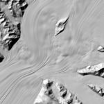
More Polar DEMs Released We’re so excited to announce our latest releases of high resolution elevation data for polar regions, … Continue reading Announcing Polar DEM Releases

Logan Earth – enhancing Google Earth with ArcticDEM for the NWT

Logan Earth – enhancing Google Earth with ArcticDEM for the NWT

Posted on April 20, 2022April 29, 2022Categories NewsTags ArcticDEM, DEM, Elevation, Geospatial, GIS, Web Map

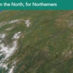
The PGC has learned a lot from users and researchers on how the ArcticDEM project enables innovative thinking and scientific … Continue reading Logan Earth – enhancing Google Earth with ArcticDEM for the NWT

High-Resolution Geospatial Mapping with Frontera

High-Resolution Geospatial Mapping with Frontera

Posted on April 8, 2022April 29, 2022Categories NewsTags ArcticDEM, DEM, EarthDEM, Elevation, Frontera, Geospatial, GIS, HPC, REMA, Supercomputer

PGC is excited to announce its newest allocation on Frontera, the largest academic supercomputer in the world located at the … Continue reading High-Resolution Geospatial Mapping with Frontera

Announcing EarthDEM!

Announcing EarthDEM!

Posted on October 29, 2021November 16, 2021Categories News, ProjectsTags Data Release, DEM, EarthDEM, Elevation, Geospatial, GIS, NASA, remote sensing, Satellite Imagery

We’re expanding beyond the polar regions! Announcing EarthDEM – High resolution (2m!) time-stamped elevation data for non-polar regions. EarthDEM’s repeat … Continue reading Announcing EarthDEM!

PGC News & Announcements (November 22, 2019)

PGC News & Announcements (November 22, 2019)

Posted on November 22, 2019December 18, 2019Categories NewsTags AGU, Awards, Elevation, Mosaic, Newsletter, PGC Users Webinar Series, Satellite Imagery, Staff News, Webinar

Missed out on the newsletter via email? Sign up here! NEW! Antarctic Multispectral Mosaic & Refresh Updates We’ve updated and … Continue reading PGC News & Announcements (November 22, 2019)

PGC and Partners Win Award for EarthDEM Collaboration

PGC and Partners Win Award for EarthDEM Collaboration

Posted on November 20, 2019January 30, 2020Categories NewsTags ArcticDEM, Awards, DEM, EarthDEM, Elevation, News, REMA, SETSM

We are honored to announce the EarthDEM team was recognized for the Best Academic / Government Collaboration in this year’s … Continue reading PGC and Partners Win Award for EarthDEM Collaboration

Blue Waters Extended to Produce Global Topography: high-resolution digital elevation models of the entire Earth

Blue Waters Extended to Produce Global Topography: high-resolution digital elevation models of the entire Earth

Posted on August 2, 2019September 5, 2019Categories NewsTags ArcticDEM, Data Release, DEM, Elevation, News, REMA, SETSM

The PGC team is excited to share the Blue Waters supercomputer at the University of Illinois at Urbana-Champaign was granted … Continue reading Blue Waters Extended to Produce Global Topography: high-resolution digital elevation models of the entire Earth

NGA Director, Robert Sharp, Praises PGC Partnership and High-Res DEMs at GEOINT 2019  [video]

NGA Director, Robert Sharp, Praises PGC Partnership and High-Res DEMs at GEOINT 2019 [video]

Posted on June 4, 2019July 22, 2019Categories NewsTags Antarctica, Arctic, ArcticDEM, Conference, DEM, Elevation, REMA, Video

At the GEOINT Symposium this year, Vice Admiral Robert Sharp, Director of the National Geospatial-Intelligence Agency (NGA) gave praising remarks … Continue reading NGA Director, Robert Sharp, Praises PGC Partnership and High-Res DEMs at GEOINT 2019 [video]

Posts pagination

Page 1 Page 2 Next page

Search

Categories

  • All
  • Boot Camp
  • Careers
  • Events
  • News
  • Projects

Archives

Tags

AGU Antarctica Arctic ArcticDEM Awards Careers Conference Conferences Data Data Release DEM Developer DigitalGlobe EarthDEM Elevation EVWHS Full-Time Jobs General Geospatial GIS Greenland Jobs Maps McMurdo News Newsletter NSF Paul Morin PGC Users Webinar Series Policy REMA remote sensing Satellite Imagery science speakers SETSM SOAC Staff News Student Student Jobs Survey Tasking Tutorial Video Webinar Website

Location

R280 Learning & Environmental Sciences
1954 Buford Avenue
Saint Paul, MN 55108
Find Us

Contact

 612-626-0505
 pgc@umn.edu
 Send Us A Message

Menu

  • About
    • Overview
    • Impact
    • People
    • Find Us
  • Data + Services
    • Overview
    • Maps
    • Satellite
    • Aerial
    • Elevation
    • ArcticDEM
    • REMA
    • Web Applications
    • Request
  • Community
  • Workshops
    • PGC Data
    • Antarctic Cable
  • Guides

Follow Us

The Polar Geospatial Center (PGC) is a research facility funded by the National Science Foundation.
PGC is a proud part of the University of Minnesota's College of Science and Engineering.

© Polar Geospatial Center. All Rights Reserved. Site by Wooly Mammoth Design.
Polar Geospatial Center
PGC Service Interruption

Important notice from the PGC.

The University of Minnesota is undergoing planned maintenance on its data center from Friday, January 5, 2017 4:00p to Sunday, January 7, 2018 12:00p. PGC services will be unavailable at that time. We apologize for any inconvenience!

PGC SERVICES IMPACTED:
  • Data downloads from HTTP/FTP Servers (public and private)
  • UMN servers hosting PGC data
  • Web mapping applications (e.g. PGC Imagery Viewers) and ArcGIS web services
PGC SERVICES NOT IMPACTED:
  • PGC Website
  • PGC Staff Email
  • ArcticDEM Web Services

 Do Not Show Again
✖

For Students, Faculty, and Staff

  • One Stop
  • My U
© 2018 Regents of the University of Minnesota. All rights reserved. The University of Minnesota is an equal opportunity educator and employer. Privacy Statement