Main navigationMain content
University of Minnesota
http://twin-cities.umn.edu/
612-625-5000
Go to the U of M home page
  • One Stop
  • MyU : For Students, Faculty, and Staff
  • About
    • Overview
    • Impact
    • People
    • Find Us
  • Data + Services
    • Overview
    • Maps
    • Satellite
    • Aerial
    • Elevation
    • ArcticDEM
    • REMA
    • Web Applications
    • Request
  • Community
  • Workshops
    • PGC Data
    • Antarctic Cable
  • Guides
  • Login
Skip to content

Hello! Login

Polar Geospatial Center Logo
  • Home
  • About
    • Overview
    • Impact
    • People
    • Find Us
    • Careers
  • Data + Services
    • Overview
    • Maps
    • Satellite
    • Aerial
    • Elevation
    • ArcticDEM
    • REMA
    • EarthDEM
    • Request
  • Community
    • News
    • Projects
    • Events
    • Workshops
    • Boot Camp
  • Web Apps
    • Fridge
    • Coordinate Converter
    • Mosaic Viewers
    • Map Catalog
    • ArcticDEM Explorer
    • REMA Explorer
    • ArcGIS Online
    • Antarctic TMA Viewer
    • COMNAP Dashboard
    • ICE-D
  • Guides
    • User Services
    • Commercial Imagery
    • Stereo Elevation Models
    • Web Mapping Applications
    • PGC Coding and Utilities
    • Miscellaneous

Tag: EVWHS

PGC News & Announcements (March 19, 2021)

PGC News & Announcements (March 19, 2021)

Posted on March 19, 2021March 31, 2021Categories NewsTags EVWHS, Greenland, Newsletter, PGC Support Vignette, QGreenland

Missed out on the newsletter via email? Sign up here! PGC Statement Supporting Our Asian Community The PGC stands firmly … Continue reading PGC News & Announcements (March 19, 2021)

Attention EVWHS / G-EGD Users

Attention EVWHS / G-EGD Users

Posted on March 2, 2021March 19, 2021Categories NewsTags Announcement, EVWHS, News, Satellite Imagery

Attention EVWHS / G-EGD Users: It has come to our attention that the National Geospatial-Intelligence Agency (NGA) is in the … Continue reading Attention EVWHS / G-EGD Users

Webinar POSTPONED: Geospatial Data for Planning Antarctic Field Seasons

Webinar POSTPONED: Geospatial Data for Planning Antarctic Field Seasons

Posted on March 23, 2020April 1, 2021Categories EventsTags Data, EVWHS, GIS, Maps, PGC Users Webinar Series, Satellite Imagery, Tutorial, Webinar

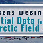
Due to unforeseen circumstances, we have postponed the scheduled webinar one week. A recording will be available upon request for … Continue reading Webinar POSTPONED: Geospatial Data for Planning Antarctic Field Seasons

Upcoming PGC Users Webinar: Geospatial Data for Planning Antarctic Field Seasons

Upcoming PGC Users Webinar: Geospatial Data for Planning Antarctic Field Seasons

Posted on March 2, 2020March 13, 2020Categories EventsTags Data, EVWHS, GIS, Maps, PGC Users Webinar Series, Satellite Imagery, Tutorial, Webinar

PGC is excited to inform United States Antarctic Program (USAP) grantees and contractors about our upcoming PGC Users Webinar Series … Continue reading Upcoming PGC Users Webinar: Geospatial Data for Planning Antarctic Field Seasons

Introduction to PGC Webinar

Introduction to PGC Webinar

Posted on November 18, 2019March 4, 2020Categories EventsTags EVWHS, GIS, PGC Users Webinar Series, Satellite Imagery, Tutorial, Webinar

Webinar materials are available on our website under ‘Education & Outreach.’ PGC is pleased to host the second event of … Continue reading Introduction to PGC Webinar

PGC Users Webinar Series  — NEW!

PGC Users Webinar Series — NEW!

Posted on September 4, 2019February 5, 2020Categories EventsTags EVWHS, GIS, PGC Users Webinar Series, Satellite Imagery, Tutorial, Webinar

Webinar materials are available on our website under ‘Education & Outreach.’ PGC is pleased to host the first of its PGC … Continue reading PGC Users Webinar Series — NEW!

Search

Categories

  • All
  • Boot Camp
  • Careers
  • Events
  • News
  • Projects

Archives

Tags

AGU Antarctica Arctic ArcticDEM Awards Careers Conference Conferences Data Data Release DEM Developer DigitalGlobe EarthDEM Elevation EVWHS Full-Time Jobs General Geospatial GIS Greenland Jobs Maps McMurdo News Newsletter NSF Paul Morin PGC Users Webinar Series Policy REMA remote sensing Satellite Imagery science speakers SETSM SOAC Staff News Student Student Jobs Survey Tasking Tutorial Video Webinar Website

Location

R280 Learning & Environmental Sciences
1954 Buford Avenue
Saint Paul, MN 55108
Find Us

Contact

 612-626-0505
 pgc@umn.edu
 Send Us A Message

Menu

  • About
    • Overview
    • Impact
    • People
    • Find Us
  • Data + Services
    • Overview
    • Maps
    • Satellite
    • Aerial
    • Elevation
    • ArcticDEM
    • REMA
    • Web Applications
    • Request
  • Community
  • Workshops
    • PGC Data
    • Antarctic Cable
  • Guides

Follow Us

The Polar Geospatial Center (PGC) is a research facility funded by the National Science Foundation.
PGC is a proud part of the University of Minnesota's College of Science and Engineering.

© Polar Geospatial Center. All Rights Reserved. Site by Wooly Mammoth Design.
Polar Geospatial Center
PGC Service Interruption

Important notice from the PGC.

The University of Minnesota is undergoing planned maintenance on its data center from Friday, January 5, 2017 4:00p to Sunday, January 7, 2018 12:00p. PGC services will be unavailable at that time. We apologize for any inconvenience!

PGC SERVICES IMPACTED:
  • Data downloads from HTTP/FTP Servers (public and private)
  • UMN servers hosting PGC data
  • Web mapping applications (e.g. PGC Imagery Viewers) and ArcGIS web services
PGC SERVICES NOT IMPACTED:
  • PGC Website
  • PGC Staff Email
  • ArcticDEM Web Services

 Do Not Show Again
✖

For Students, Faculty, and Staff

  • One Stop
  • My U
© 2018 Regents of the University of Minnesota. All rights reserved. The University of Minnesota is an equal opportunity educator and employer. Privacy Statement