
EarthDEM
High-resolution Digital Surface Models (DSM) in non-polar regions
at 2-meter spatial resolution.
Want to jump right to the data?
We encourage you to read this documentation, but the data are available from the
NASA Commercial Satellite Data Acquisition (CSDA) Program
Satellite Data Explorer.
NASA CSDA Satellite data Explorer
Want to stay updated?
Subscribe to our mailing list.
Overview
Purpose
The EarthDEM Project provides high-resolution terrain maps for temperate and tropic regions. The resulting individual DSMs can be used to provide measurements of elevation change through time. The mosaic products offer a seamless, high-resolution reference model to serve as the foundation for further geospatial analysis and modeling.
EarthDEM products are constructed using hundreds of thousands of individual stereoscopic Digital Elevation Models (DEM) extracted from pairs of submeter (0.32 to 0.5 m) resolution Maxar satellite imagery obtained through the NGA EOCL license. Source imagery is from WorldView-1, WorldView-2, and WorldView-3, and a small number from GeoEye-1, acquired between 2009 and the present.
Access
Current licensing restrictions limit the release of non-polar DEMs derived from Maxar imagery to federal employees/contractors and federally-funded researchers. Eligibility will be verified by the NASA Commercial Smallsat Data Acquisition Program (CSDA) Program before data access is granted. Once the data become available, apply for an account using the CSDA account request form.
The Great Lakes Alliance for Remote Sensing (GLARS) makes publicly available a subset of EarthDEM elevation models around the Great Lakes of North America. Visit the GLARS website to access these datasets.
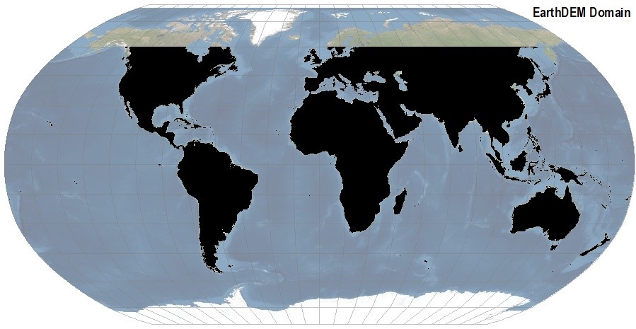
Domain
The EarthDEM project covers land surface between 60 degrees N and 60 degrees South excluding Alaska, Greenland, and the Kamchatka Peninsula. Polar data is openly available and can be found on the REMA and ArcticDEM pages.
New areas will be released as new data acquisition gives sufficient coverage. See the strip and mosaic tile status maps below for exact coverage areas.
Processing
EarthDEM products are generated by applying fully automated, stereo auto-correlation techniques to overlapping pairs of high-resolution optical satellite images.
Using the open-source Surface Extraction from TIN-based Search-space Minimization (SETSM) software, developed by M.J. Noh and Ian Howat at the Ohio State University with support from the Ohio Supercomputer Center, stereoscopic images were processed to Digital Elevation Models using compute resources provided by the Texas Advanced Computing Center at the University of Texas at Austin and the National Center for Supercomputing Applications at the University of Illinois at Urbana-Champaign.
National Science Foundation funding supported the significant compute resources and development of the production pipeline and algorithms through earlier projects including ArcticDEM and REMA.
Output
Output DEMs are available as both original “strip” DEMs that preserve the original source imagery acquisition dates and temporal characteristics, as well as mosaic tiles that are compiled from multiple strips in a median-style mosaicking method that co-registers, filters, and integrates the source DEMs to reduce erroneous data and edge artifacts.
The time-dependent nature of the strip DEM files allows users to perform change detection analysis and to compare observations of topography data acquired in different seasons or years. The mosaic DEM tiles are assembled from multiple strip DEMs with the objective of providing a more consistent and comprehensive product over larger areas.
Documentation
Refer to these documents and guides for official EarthDEM information & citation.
Citation
Along with acknowledging the PGC, the EarthDEM dataset should be cited as follows:
Strips:
Porter, Claire; Howat, Ian; Husby, Erik; Noh, Myoung-Jon; Khuvis, Samuel; Danish, Evan; Tomko, Karen; Gardiner, Judith; Negrete, Adelaide; Yadav, Bidhyananda; Klassen, James; Kelleher, Cole; Cloutier, Michael; Bakker, Jesse; Power, Devin; Enos, Jeremy; Arnold, Galen; Bauer, Greg; Morin, Paul, 2024, “EarthDEM – Strips, Version 4.1”, https://doi.org/10.7910/DVN/YJAH5X, Harvard Dataverse, V1, [Date Accessed].
Mosaics:
Porter, Claire; Howat, Ian; Husby, Erik; Noh, Myoung-Jon; Power, Devin; Khuvis, Samuel; Danish, Evan; Tomko, Karen; Gardiner, Judith; Negrete, Adelaide; Yadav, Bidhyananda; Klassen, James; Kelleher, Cole; Cloutier, Michael; Bakker, Jesse; Enos, Jeremy; Arnold, Galen; Bauer, Greg; Morin, Paul, 2024, “EarthDEM – Mosaics, Version 1.1”, https://doi.org/10.7910/DVN/L2BEKY, Harvard Dataverse, V1, [Date Accessed].
Current Release
October 2025 Release
EarthDEM’s October 2025 Release contains more than half Earth’s non-polar land surface areas, including most of North and South America and large portions of Africa, Eurasia, and Australia/Oceania. Products include 50 km x 50 km mosaic tiles and strip DEMs, both at 2-meter resolution. The sections below provide more detail of each product.
For both strips and mosaics, vector datasets are available as an index (footprint polygons), compatible with most GIS software. Unlike the REMA and ArcticDEM datasets, download links are not included as an attribute. Data will be available for download (after eligibility verification) through the NASA CSDA Satellite Data Explorer.
EarthDEM Strips
Strip DEM files correspond to the overlapping area of the input stereoscopic imagery pair strips as they are collected by Maxar’s constellation of polar-orbiting satellites. Strip DEM dimensions will vary according to the satellite sensor that acquired the images and the off-nadir angle of collection. Most strips are between 13 km and 17 km in width, and 110 km and 120 km in length.
Strip DEM files are provided at 2-meter spatial resolution in 32-bit GeoTIFF format. The horizontal coordinate system is the UTM zone (WGS84 ellipsoid) in which the strip falls. Elevation units are meters and are relative to the WGS84 ellipsoid. No ground control or altimetry registration has been applied to the strips.

STATISTICS
-
TOTAL STRIPS
- 363,560
-
TOTAL STRIP DEM FILE SIZE
- 210 TB
-
STRIP DEM DATES
- 2009-2024
DATA EXTENT
EarthDEM Strip DEM extent index with links
( SHP | GDB | GPKG | PARQUET )
DATA ACCESS
Access 2m EarthDEM Strips (via NASA CSDA)
EarthDEM Mosaic
Version 1.1 Mosaic
In addition to the individual time-stamped strips, EarthDEM includes a mosaic in 50 km x 50 km mosaic tiles at 2-meter resolution. A reduced-resolution, 10-meter resampled version is also available. Elevation units are meters and are relative to the WGS84 ellipsoid. No ground control or altimetry registration has been applied to the mosaics.

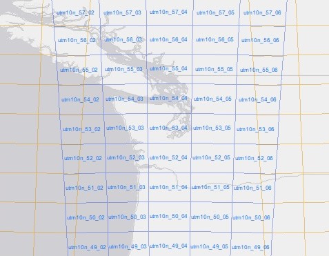
MOSAIC SCHEMA
2m mosaic tiles are in the local UTM projection. There is a different mosaic tiling scheme for each UTM zone, but each zone overlaps adjacent zones. Detailed mosaic tiling scheme information can be found in the EarthDEM documentation.
Methodology
DEM mosaic tiles are formed into 100km x 100 km tiles in the local UTM projection. The mosaic provides the median value of elevations from repeat strip DEMs, with filtering applied to remove outliers. The number of repeat DEMs, the median absolute deviation, and the time range of DEM acquisitions at each mosaic pixel are provided to identify potential areas of poor quality data and highlight rapidly changing features. The full tiles are subset to 50 x 50 km for distribution and feathered along their edges to remove any abrupt discontinuities. See the documentation for more information.
STATISTICS
-
VERSION 4.1 – TOTAL MOSAIC TILES (2m)
- 32,480
-
TOTAL MOSAIC TILE FILE SIZE
- 52 TB
DATA EXTENT
EarthDEM Mosaic extent index
( SHP | GDB | GPKG | PARQUET )
DATA ACCESS
Access EarthDEM mosaics (via NASA CSDA)
Press
Articles
- NASA Press Release: New in CSDA: High Resolution Digital Elevation Models (10/29/2021)