

Missed out on the newsletter via email? Sign up here!
PGC Statement Supporting Our Asian Community
Attention EVWHS / G-EGD Users
It has come to our attention that the National Geospatial-Intelligence Agency (NGA) is in the process of de-activating some EVWHS / G-EGD user accounts. PGC staff accounts are not excluded from this process and are no longer active.
PGC support to federally funded researchers through the National Science Foundation’s Office of Polar Programs is uninterrupted and ongoing. Please contact your PGC Point-of-Contact or pgc-support@umn.edu for any further imagery requests related to NSF OPP awards. Due to our substantial intake process – ingesting, cataloguing and storing thousands of satellite images each week – turnaround times are unlike the EVWHS process. Please plan accordingly with your PGC POC and thank you for your patience. We encourage EVWHS / G-EGD users with questions and concerns to contact NGA at ngaegdadmin@nga.mil.
Unfortunately, our support does not currently extend to those funded outside of NSF OPP. We apologize for the inconvenience.
QGreenland Release
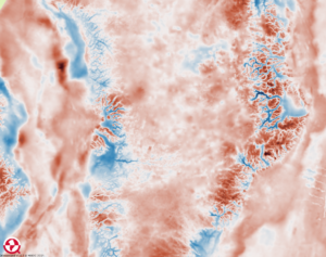 A free mapping tool to explore an incredible collection of Greenland-focused interdisciplinary data, QGreenland, was released last month (February 2021). It features PGC’s ArcticDEM and is mirrored on PGC servers. A free mapping tool to explore an incredible collection of Greenland-focused interdisciplinary data, QGreenland, was released last month (February 2021). It features PGC’s ArcticDEM and is mirrored on PGC servers.
Users can access the package online or offline and run it on QGIS, a free GIS software available for Mac, Windows, and Linux. The QGreenland Team also encourages data contributions and feedback from the community, especially for inclusion in future releases. Check out QGreenland Github page for details.
PGC Support VignettePGC products and services enable scientists and logistic operations from varying disciplines to discover new insights into the polar regions.
Here is a highlight of our uses’ successes: Yaping Chen, Feng Sheng Hu, and Mark Lara, PGC users and interdisciplinary systems scientists, have utilized aerial photographs from NASA and high-resolution satellite imagery from PGC. Their study conducts a time series analysis of shrubification and key environmental drivers, such as climate change and fire disturbances, across the Noatak National Preserve (NOAT) of northern Alaska. The higher spatial resolution of imagery (<2m) enabled Chen et al. to adequately identify individual shrub canopies. The NOAT is an important study site as it is one of the most flammable tundra ecosystems on Earth. The 40+ years analysis revealed multiple trajectories to shrubification due to warming tundra, wildfires, and spatial heterogeneity. Read their article published in the Global Change Biology journal. PGC’s Year at HomeIt’s been a year. PGC has reached, like many others, its one-year anniversary of working from home. It has been difficult but the PGC’s top priorities remain to be the health and well-being of our communities and our ongoing commitment to supporting the polar sciences. Regardless of the challenges, we wanted to mark this milestone by sharing a glimpse into our home offices (and unofficial coworkers).
|
| Read the original PGC Newsletter post here. |


