
The REMA team is proud to announce its publication in The Cryosphere journal! The article covers REMA’s construction including source imagery and DEM processing, registering and mosaicking, as well as comparisons to lidar altimetry. The state-of-the-art techniques REMA has employed developing high-resolution continental-wide elevation mapping is a powerful new resource for science in a rapidly changing world.
Article
https://www.the-cryosphere.net/13/665/2019/
Citation
Howat, I. M., Porter, C., Smith, B. E., Noh, M.-J., and Morin, P.: The Reference Elevation Model of Antarctica, The Cryosphere, 13, 665-674, https://doi.org/10.5194/tc-13-665-2019, 2019.
overview
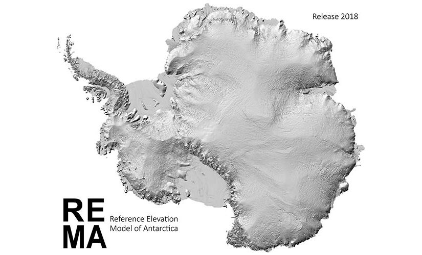
REMA is constructed from hundreds of thousands of individual stereoscopic Digital Elevation Models (DEM) extracted from pairs of submeter resolution DigitalGlobe satellite imagery licensed by the National Geospatial-Intelligence Agency, including data from WorldView-1, WorldView-2, and WorldView-3 acquired between 2009 and 2017, with most collected in 2015 and 2016.
REMA is generated by applying fully automated, stereo auto-correlation techniques to overlapping pairs of high-resolution optical satellite images using the open source Surface Extraction from TIN-based Searchspace Minimization (SETSM) software, developed by M.J. Noh and Ian Howat at the Ohio State University. The images are processed to Digital Elevation Models using compute resources provided through an Innovation Allocation on the Blue Waters supercomputer located at the National Center for Supercomputing Applications at the University of Illinois at Urbana-Champaign.
STAY UPDATED
Click here to subscribe to occasional PGC Elevation updates via email.