
We’re expanding beyond the polar regions! Announcing EarthDEM – High resolution (2m!) time-stamped elevation data for non-polar regions. EarthDEM’s repeat observations allow unprecedented change detection while its polished mosaic models provide beautiful visualization and comprehensive coverage. Select regions of the planet are available today with more to come.
EarthDEM is built collaboratively by PGC and partners at NASA, the National Science Foundation, The Byrd Polar and Climate Research Center at The Ohio State University, the National Center for Supercomputing Applications at the University of Illinois, and government partners.
The EarthDEM products are available to U.S. federal employees, U.S. federal contractors, and U.S. government-funded researchers. To gain access, users can submit an access request form and agree to an End User License Agreement (EULA). Once access is granted, DEMs can be searched and downloaded using NASA’s Commercial Smallsat Data Acquisition Smallsat Data Explorer tool.
We’re excited to see what users can discover using this vast dataset!
Help us spread the word about EarthDEM by sharing our posts on Facebook, Twitter, and Instagram.
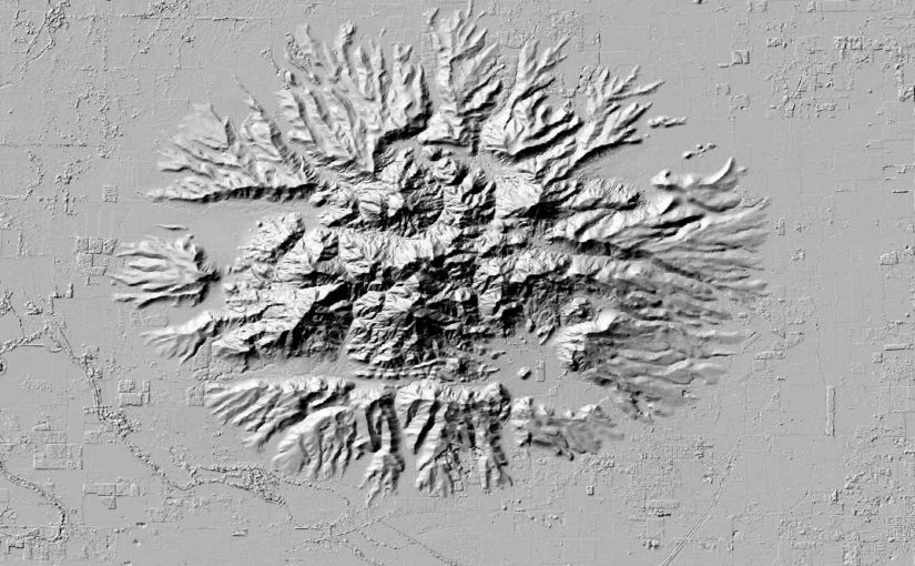
Header image is a hillshade of Caldwell Hills, CA. DEM derived from Maxar imagery.