
The PGC has learned a lot from users and researchers on how the ArcticDEM project enables innovative thinking and scientific advancement. We recognize the societal implications of PGC’s products derived from commercial imagery is especially important and relevant for data-poor communities, communities that cannot access enough data or access high quality data for their needs.
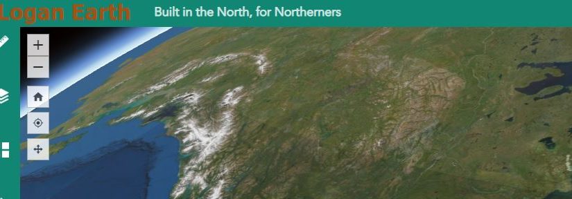
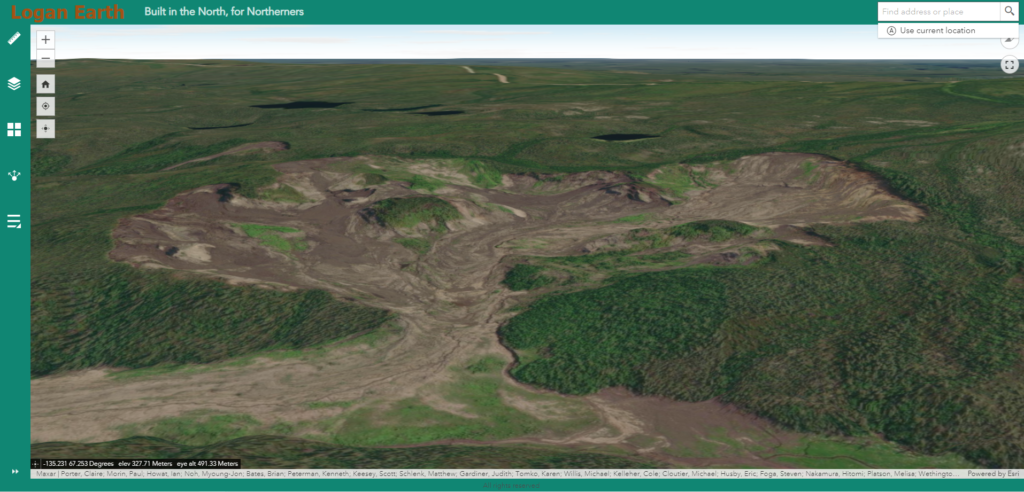
The PGC was thrilled to learn about Logan Earth (loganearth.com), an ESRI app using ArcticDEM for the Canadian Northwest Territories (NWT). The creator, Logan Rudkevitch, of Métis and Wiikwemkoong ancestry born and raised in Yellowknife, recognized communities in the north are poorly served by the southern focus of Google Earth. Rudkevitch used the high resolution ArcticDEM mosaic tiles to enable a 3d view of the NWT that is much better than what is seen from Google Earth. Read more about the motivation behind Logan Earth in the featured press release, support the costs of the app on patreon, and check out the app in the links below.
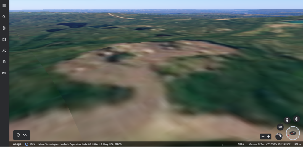
Google Earth (above) vs. Logan Earth (below) comparison of a permafrost slump on the Peel Plateau in NWT
helpful links:
Cabin Radio Press Release: https://cabinradio.ca/88612/news/environment/yellowknife-man-creates-alternative-to-google-earth-for-northerners/
Logan Earth Patreon: https://www.patreon.com/LoganEarth
Logan Earth App: https://northernmademaps.maps.arcgis.com/apps/webappviewer3d/index.html?id=c01df3f8136e4c718a1bfe8377951352
PGC’s Arctic DEM Webpage: https://www.pgc.umn.edu/data/arcticdem/