Revolutionizing Arctic Topography Mapping: ArcticDEM Mosaic Release 2023
[Twin Cities, 08/17/2023] – The Polar Geospatial Center (PGC) at the University of Minnesota is proud to present ArcticDEM Mosaic version 4.1, a culmination of rigorous efforts to elevate the quality, precision, and utility of elevation data in the Arctic region. The ArcticDEM project is the result of an extraordinary collaborative effort, harnessing the power of advanced satellite imagery, remote sensing technologies, and innovative data processing techniques. The project has successfully generated highly accurate, detailed, and up-to-date digital elevation models (DEMs) that empower researchers and decision-makers to address critical challenges such as rising sea levels, coastal erosion, and the preservation of fragile Arctic ecosystems.
The mosaics are made up of the entire stack of individual strip DEMs and therefore are not intended for temporal research but most valuable for visualizations and comprehensive coverage. Since 2020, the PGC has employed a sophisticated median-style mosaicking technique (read more below), ensuring exceptional reliability and refinement. With a focus on accuracy and usability, this release marks a significant leap forward in our mission and in the realm of Arctic topographic mapping. ArcticDEM provides unprecedented access to high-resolution digital elevation models for free. Explore the future of elevation data with ArcticDEM version 4.1 today!
What’s New in the August 2023 Release?
Key features and improvements of ArcticDEM mosaic version 4.1 include:
- Median-Style Mosaicking for Unparalleled Accuracy: This technique calculates the median elevation value from repeat strip Digital Elevation Models at each pixel, while effectively filtering out outliers. This approach not only guarantees superior accuracy but also enhances the robustness of the data. To assist in identifying potential low-quality data zones and rapidly changing features, auxiliary files containing details about the number of repeat DEMs, median absolute deviation, and acquisition time range for each mosaic pixel are provided.
- Enhanced Data Distribution and Continuity: To ensure seamless integration and easy access, full tiles have been thoughtfully subset to 50 x 50 km dimensions for distribution. Moreover, we’ve taken strides to eliminate abrupt disruptions along tile edges by feathering, enhancing the overall visual coherence of the dataset.
- Refined Post-Processing Techniques: A major highlight of ArcticDEM version 4.1 is the utilization of advanced post-processing methodologies. Specifically, for Greenland, we’ve employed the same proven approach from REMA version 2 to suppress low-quality data over oceanic regions while adding sea surface height information to enrich the dataset. Furthermore, meticulous alignment between the 2m tile data and a 10m version of the Greenland Ice Mapping Project (GrIMP) version 2 DEM has been executed to enhance surface height consistency across tile borders.
- Featuring Hydro-Flattening for Water Surfaces: In pursuit of perfection, we’ve introduced a hydro-flattening procedure to water surfaces. For tiles beyond Greenland, the ESA WorldCover 2020 dataset’s “Permanent water bodies” class has been employed to achieve this. This fill operation replaces erroneous elevation data in water bodies with the reliable Copernicus DEM GLO-30 product, ensuring precise representations of aquatic terrains.
- Focused Attention on Glaciers and Quality Control: Special attention has been dedicated to Greenland’s fast-moving glaciers and select Arctic locations. Annual time-slice mosaics have been meticulously generated, and the most recent year with comprehensive coverage and consistent surfaces has been seamlessly integrated into the all-years median mosaic outcomes. Additionally, the automatic blunder-detection filter that identifies and masks out NoData areas in the DEM where significant slope discrepancies arise underscores our commitment to quality control.
View our interactive story map for visualizations of these improvements here:
What are PGC’s DEM Products?
The Polar Geospatial Center’s ArcticDEM, REMA, and EarthDEM elevation products are the result of an institutional collaboration between the U.S. National Geospatial-Intelligence Agency (NGA) and the National Science Foundation (NSF). The objective of these efforts are to automatically produce high-resolution, high-quality digital surface models (DSM) of polar and select mid-latitude regions using optical imagery, high-performance computing, and open source photogrammetry software. The result is a collection of time-dependent DSM strips and seamless terrain mosaics. The polar projects, ArcticDEM and REMA, and select nonpolar regions can be used and distributed without restriction. The EarthDEM products are available to U.S. federal employees, U.S. federal contractors, and U.S. government-funded researchers.
Why Use ArcticDEM data?
Key features and benefits of ArcticDEM include:
- Unrivaled Accuracy and Precision: offers an unparalleled level of accuracy and precision in depicting the Arctic’s ever-changing terrain. Researchers and climate scientists can utilize these elevation models to monitor and model glacier dynamics, track permafrost changes, and assess the impacts of climate change on the polar environment.
- Global Accessibility: publicly available and free of charge to users worldwide. This democratized access encourages interdisciplinary collaboration and facilitates the development of innovative solutions to the challenges facing the Arctic region.
- Versatility: applications across various sectors, including scientific research, disaster response, navigation, and natural resource management. Its high-resolution data enables and extends accurate mapping for a diverse range of projects and studies.
- Long-term Access: t he U.S. National Science Foundation (NSF), the National Geospatial-Intelligence Agency (NGA) and the National Reconnaissance Office (NRO) recently finalized an agreement to provide continued public access to historical and new digital elevation models created using commercial imagery collected over the Arctic and Antarctic (except Alaska) through 2032. The 10-year extension ensures that researchers and stakeholders have access to the recent and relevant elevation data. Read the NSF press release here and the NGA here.
- User-Friendly Interface: navigating the ArcticDEM data is made effortless through intuitive online interfaces. Users can easily browse, visualize, and download elevation models tailored to their specific needs from multiple access points including web map apps, WMS, AWS, and more. Visit the ArcticDEM webpage to learn more.
SPECIAL THANKS
The ArcticDEM project is a testament to the power of collaboration, innovation, and the drive to make a positive impact on our world. The Polar Geospatial Center extends its gratitude to the contributors, partners, and stakeholders who have played a vital role in making ArcticDEM a reality.
About the Polar Geospatial Center: The Polar Geospatial Center (PGC) at the University of Minnesota is a leading institution in geospatial research and data collection focused on polar regions. PGC is committed to advancing polar science, promoting interdisciplinary collaboration, and providing valuable geospatial resources to the global community.
Help us spread the word about PGC’s DEMs by sharing our posts on Facebook, Twitter, and Instagram.
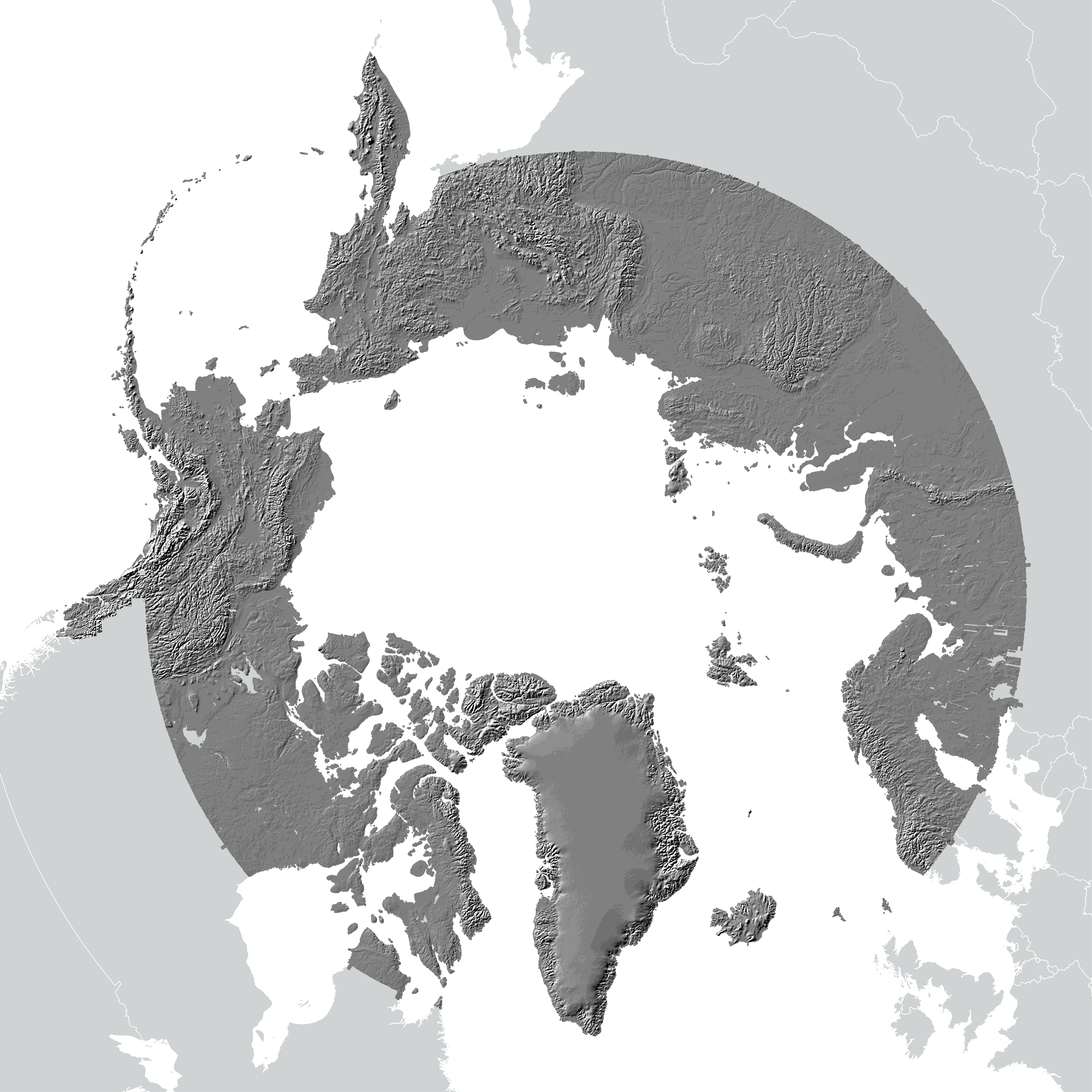
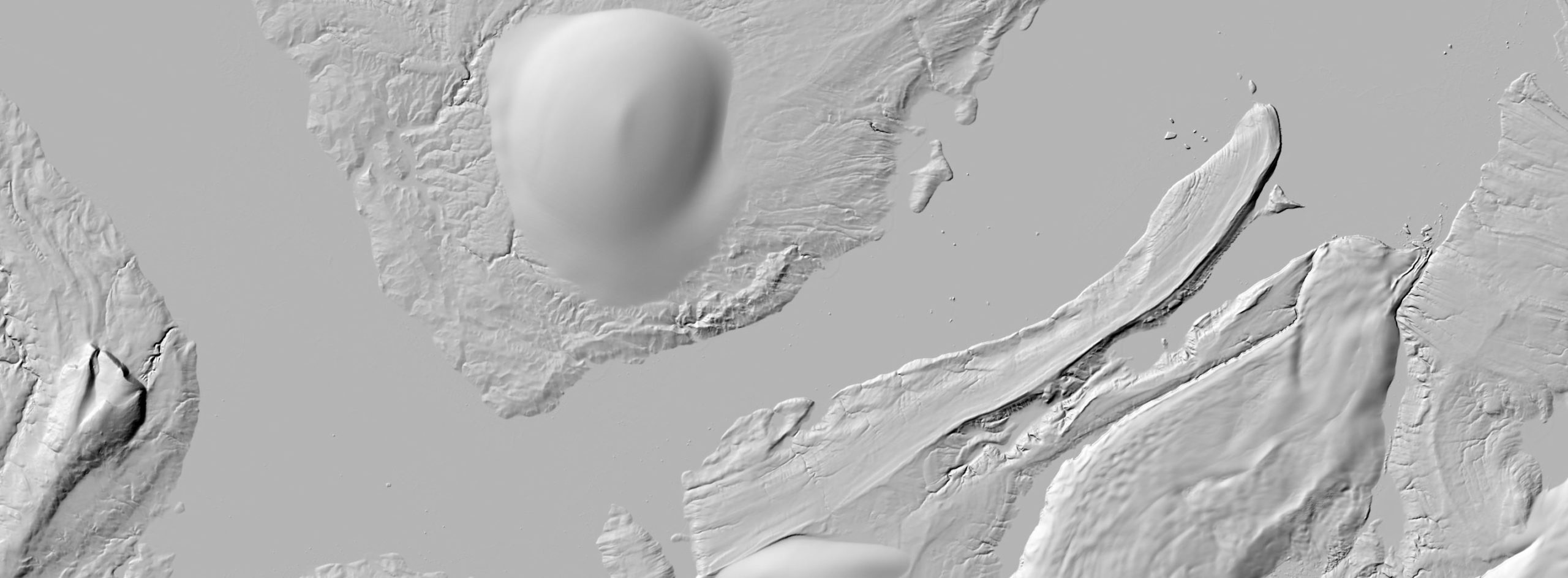
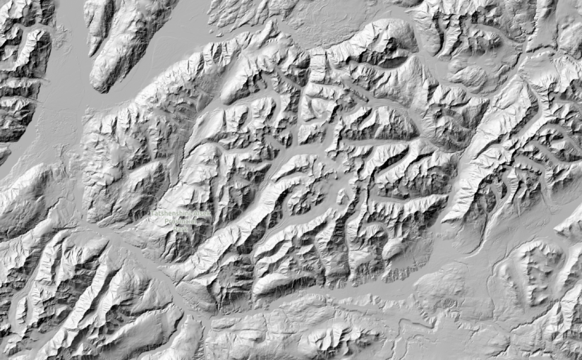
ArcticDEM mosaic hillshade comparisons between v3 and v4.1 (top). ArcticDEM hillshade of Severnaya Zemlya (bottom). DEMs derived from Maxar imagery.