Main navigationMain content
University of Minnesota
http://twin-cities.umn.edu/
612-625-5000
Go to the U of M home page
  • One Stop
  • MyU : For Students, Faculty, and Staff
  • About
    • Overview
    • Impact
    • People
    • Find Us
  • Data + Services
    • Overview
    • Maps
    • Satellite
    • Aerial
    • Elevation
    • ArcticDEM
    • REMA
    • Web Applications
    • Request
  • Community
  • Workshops
    • PGC Data
    • Antarctic Cable
  • Guides
  • Login
Skip to content

Hello! Login

Polar Geospatial Center Logo
  • Home
  • About
    • Overview
    • Impact
    • People
    • Find Us
    • Careers
  • Data + Services
    • Overview
    • Maps
    • Satellite
    • Aerial
    • Elevation
    • ArcticDEM
    • REMA
    • EarthDEM
    • Request
  • Community
    • News
    • Projects
    • Events
    • Workshops
    • Boot Camp
  • Web Apps
    • Fridge
    • Coordinate Converter
    • Mosaic Viewers
    • Map Catalog
    • ArcticDEM Explorer
    • REMA Explorer
    • ArcGIS Online
    • Antarctic TMA Viewer
    • COMNAP Dashboard
    • ICE-D
  • Guides
    • User Services
    • Commercial Imagery
    • Stereo Elevation Models
    • Web Mapping Applications
    • PGC Coding and Utilities
    • Miscellaneous

Tag: Elevation

REMA Publication

REMA Publication

Posted on March 1, 2019March 15, 2019Categories NewsTags Antarctica, Data Release, DEM, Elevation, REMA, SETSM

The REMA team is proud to announce its publication in The Cryosphere journal! The article covers REMA’s construction including source … Continue reading REMA Publication

ArcticDEM Release 7

ArcticDEM Release 7

Posted on September 28, 2018March 4, 2019Categories NewsTags Arctic, ArcticDEM, Data Release, DEM, Elevation, Newsletter

ArcticDEM Release 7 is a complete re-release of the Arctic at 2-meter resolution.

The Reference Elevation Model of Antarctica: Release 1

The Reference Elevation Model of Antarctica: Release 1

Posted on September 4, 2018March 4, 2019Categories ProjectsTags Antarctica, Data Release, DEM, Elevation, REMA

First release of the high-resolution Digital Elevation Model of Antarctica (REMA).

AGU Session: High Resolution Topography in the Geosciences

AGU Session: High Resolution Topography in the Geosciences

Posted on July 5, 2018July 5, 2018Categories EventsTags Conference, DEM, Elevation, Paul Morin

Please consider submitting an abstract to our Geodesy session at the Fall AGU meeting in Washington DC, “An Ongoing Transformation: High Resolution Topography in the Geosciences.”

ArcticDEM Release 6

ArcticDEM Release 6

Posted on September 6, 2017June 6, 2018Categories News, ProjectsTags ArcticDEM, Data Release, DEM, Elevation

ArcticDEM Release 6 adds much of Russia and Scandinavia. ArcticDEM now covers 97% of the Arctic.

SETSM 3.1.0 Open Release

SETSM 3.1.0 Open Release

Posted on February 24, 2017June 6, 2018Categories NewsTags ArcticDEM, DEM, Elevation, SETSM

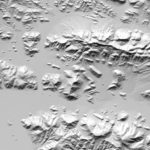
About SETSM The Surface Extraction with TIN-based Search-space Minimization (SETSM) algorithm, is the first fully-automatic DEM extraction software specifically designed … Continue reading SETSM 3.1.0 Open Release

Posts pagination

Previous page Page 1 Page 2

Search

Categories

  • All
  • Boot Camp
  • Careers
  • Events
  • News
  • Projects

Archives

Tags

AGU Antarctica Arctic ArcticDEM Awards Careers Conference Conferences Data Data Release DEM Developer DigitalGlobe EarthDEM Elevation EVWHS Full-Time Jobs General Geospatial GIS Greenland Jobs Maps McMurdo News Newsletter NSF Paul Morin PGC Users Webinar Series Policy REMA remote sensing Satellite Imagery science speakers SETSM SOAC Staff News Student Student Jobs Survey Tasking Tutorial Video Webinar Website

Location

R280 Learning & Environmental Sciences
1954 Buford Avenue
Saint Paul, MN 55108
Find Us

Contact

 612-626-0505
 pgc@umn.edu
 Send Us A Message

Menu

  • About
    • Overview
    • Impact
    • People
    • Find Us
  • Data + Services
    • Overview
    • Maps
    • Satellite
    • Aerial
    • Elevation
    • ArcticDEM
    • REMA
    • Web Applications
    • Request
  • Community
  • Workshops
    • PGC Data
    • Antarctic Cable
  • Guides

Follow Us

The Polar Geospatial Center (PGC) is a research facility funded by the National Science Foundation.
PGC is a proud part of the University of Minnesota's College of Science and Engineering.

© Polar Geospatial Center. All Rights Reserved. Site by Wooly Mammoth Design.
Polar Geospatial Center
PGC Service Interruption

Important notice from the PGC.

The University of Minnesota is undergoing planned maintenance on its data center from Friday, January 5, 2017 4:00p to Sunday, January 7, 2018 12:00p. PGC services will be unavailable at that time. We apologize for any inconvenience!

PGC SERVICES IMPACTED:
  • Data downloads from HTTP/FTP Servers (public and private)
  • UMN servers hosting PGC data
  • Web mapping applications (e.g. PGC Imagery Viewers) and ArcGIS web services
PGC SERVICES NOT IMPACTED:
  • PGC Website
  • PGC Staff Email
  • ArcticDEM Web Services

 Do Not Show Again
✖

For Students, Faculty, and Staff

  • One Stop
  • My U
© 2018 Regents of the University of Minnesota. All rights reserved. The University of Minnesota is an equal opportunity educator and employer. Privacy Statement