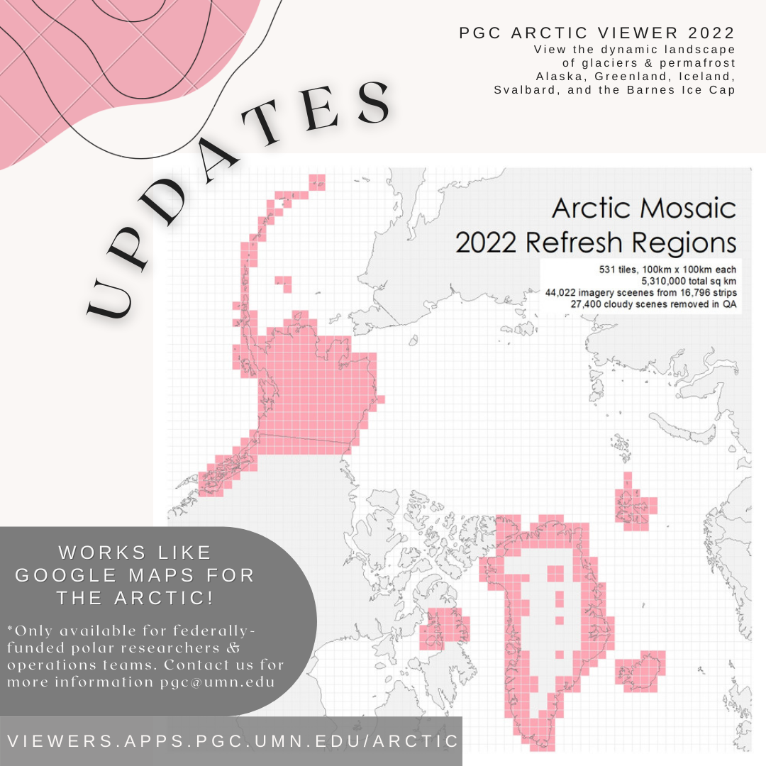
The Arctic Imagery Mosaic is updated and live! Our team of staff and students have spent hours of manual quality assessment and processing to provide newer 50 cm imagery mosaics across high priority areas before the start of the Arctic field season.
Update efforts cover 531 tiles (100 x 100km each) totalling 5,310,000 sqkm assembled from 44,022 imagery scenes, which 27,400 cloudy scenes removed during QA! New coverage has 81% of scenes collected between 2019-2021. Updated tiles were selected based on PGC User priority areas and satellite tasking requests, designed to refresh areas of highest interest from the community. Coverage in the update includes the Barnes Ice Cap in Canada, the full coast of Greenland, the islands of Iceland and Svalbard, and all of Alaska.
Due to licensing restrictions, the imagery mosaics are only available to federally-funded polar researchers, operations subcontractors, and federal employees with a PGC verified account required (detailed links below).
PGC users can access the data layers in desktop GIS (see guide below) or in our browser-based web-mapping application, the Arctic Viewer at https://viewers.apps.pgc.umn.edu/arctic.