
PGC News & Announcements: June 15, 2018
Missed out on the newsletter via email? Sign up here!
New NGA Approval for Public Release of Commercial Satellite Imagery
At the beginning of 2018, the National Geospatial-Intelligence Agency (NGA) made important changes to NextView licensed imagery and imagery derived products used in the public domain. An approval from NGA is now required for public release of commercial satellite imagery.
The purpose and background of the approval framework can be found here.
PGC is facilitating the approval process for Users. A typical response period from submission request to approval decision is within 24 hours. More information on the approval process can be found in the following Guide:
Citation and Publication Approval
Antarctic Tasking Requests Due July 20th, 2018
PGC is working with the National Geospatial-Intelligence Agency (NGA) to coordinate collections of high-resolution commercial satellite imagery from DigitalGlobe for the upcoming 2018-19 Antarctic field season.
Please get in touch with your PGC Point of Contact if you would like to submit tasking requests for your area(s) of interest. The deadline for requests for the upcoming Antarctic field season is July 20th, 2018.
Note that submissions from previous seasons no longer carry over into the upcoming season. If you have submitted a request for a previous year and would like to have imagery collected for a future season you must submit a new tasking request through your POC.
PGC Antarctic Imagery Mosaic Refresh
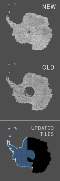
We’ve given a major update to our Antarctic 50 cm imagery mosaic available to Users in our web-based mapping application. PGC’s Antarctic, Arctic and World imagery viewers provide quick access to hundreds of terabytes of orthorectified satellite imagery, mostly of WorldView-1, -2 and -3 sensors. More information about our viewers can be found on our website.
Here are the major improvements highlighted:
- Updated West Antarctica to create a near-seamless, low cloud cover mosaic using the most recent imagery (current up to 2017)
- Updated tiles cover 47% (6,390,000 km²) See bottom left image
- 26% of previous West Antarctic mosaic was fill (1,646,765 km²)
- 1.1% of current West Antarctic mosaic is fill (mostly south of 88° latitude)
- Significant coverage was added south of 84° latitude
Access to secured and licensed data layers in PGC’s Imagery Viewers are restricted to current federally-funded polar researchers, federal employees, or subcontractors. New users can request an account here.
PGC verifies all funding sources after you submit a request.
Reference Elevation Model of Antarctica (REMA) Release Coming This Summer 2018
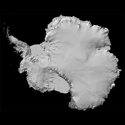
The Byrd Polar & Climate Research Center at The Ohio State University, in collaboration with the PGC, is planning to release this summer the Reference Elevation Model of Antarctica (REMA).
REMA is built from stereoscopic high-resolution satellite imagery collected by the WorldView sensors. REMA uses Cryosat to register DEMs and LiDAR surveys for accuracy assessment. Mosaicked DEMs provided at 8m and 100m spatial resolutions will be released, free and open to the public. The previously available pan-Antarctic DEM was 200m resolution.
The project is supported by the U.S. National Science Foundation Division of Polar Programs. Learn more about the REMA award here. More information and downloads will be provided on the PGC website at release.
ArcticDEM Final Release Coming September 2018
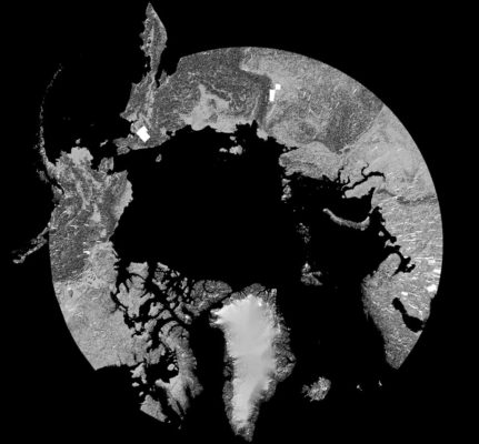
PGC is excited for our 7th and final release of ArcticDEM coming this September 2018. This release will feature significant improvements and updates including:
- Re-filtered strip DEMs for the entire Arctic with improved blunder and cloud detection and reduced over-filtering on forested areas
- New DEMs added more depth to the temporal archive. Each location is covered an average of 8 times
- An improved mosaic with terrain now filling many of the previous data gaps
- The mosaic will be released at 2m, 10m, 30m and 100m resolutions
Learn more about ArcticDEM here. Sign up for the latest ArcticDEM updates: ArcticDEM Newsletter!
DigitalGlobe EVWHS Extension April 2019
The National Geospatial-Intelligence Agency has contracted with DigitalGlobe to provide a viewer and web service to deliver imagery products, the Enhanced View Web Hosting Service (EVWHS). The service has been given an extension until April 2019. PGC will provide updates as they become available. Please contact your POC to request an EVWHS account and with any further questions or concerns.
Read the original PGC Newsletter post here.