Main navigationMain content
University of Minnesota
http://twin-cities.umn.edu/
612-625-5000
  1. One Stop
  2. MyU : For Students, Faculty, and Staff
  • About
    • Overview
    • Impact
    • People
    • Find Us
  • Data + Services
    • Overview
    • Maps
    • Satellite
    • Aerial
    • Elevation
    • ArcticDEM
    • REMA
    • Web Applications
    • Request
  • Community
  • Workshops
    • PGC Data
    • Antarctic Cable
  • Guides
  • Login
Skip to content

Hello! Login

Polar Geospatial Center Logo
  • Home
  • About
    • Overview
    • Impact
    • People
    • Find Us
    • Careers
  • Data + Services
    • Overview
    • Maps
    • Satellite
    • Aerial
    • Elevation
    • ArcticDEM
    • REMA
    • EarthDEM
    • Request
  • Community
    • News
    • Projects
    • Events
    • Workshops
    • Boot Camp
  • Web Apps
    • Fridge
    • Coordinate Converter
    • Mosaic Viewers
    • Map Catalog
    • ArcticDEM Explorer
    • REMA Explorer
    • ArcGIS Online
    • Antarctic TMA Viewer
    • COMNAP Dashboard
    • ICE-D
  • Guides
    • User Services
    • Commercial Imagery
    • Stereo Elevation Models
    • Web Mapping Applications
    • PGC Coding and Utilities
    • Miscellaneous

Tag: ArcticDEM

High-Resolution Geospatial Mapping with Frontera

High-Resolution Geospatial Mapping with Frontera

Posted on April 8, 2022April 29, 2022Categories NewsTags ArcticDEM, DEM, EarthDEM, Elevation, Frontera, Geospatial, GIS, HPC, REMA, Supercomputer

PGC is excited to announce its newest allocation on Frontera, the largest academic supercomputer in the world located at the … Continue reading High-Resolution Geospatial Mapping with Frontera

PGC News & Announcements (December 17, 2021)

PGC News & Announcements (December 17, 2021)

Posted on December 16, 2021December 18, 2025Categories NewsTags AGU, Antarctica, Arctic, ArcticDEM, Documentary, EarthDEM, News, Newsletter, REMA, Satellite Imagery, Staff News, Tasking, Viewers

Missed out on the newsletter via email? Sign up here! PGC Welcomes Stephanie Linde We would like to extend a … Continue reading PGC News & Announcements (December 17, 2021)

PGC Recognized by Director of National Intelligence

PGC Recognized by Director of National Intelligence

Posted on December 3, 2021December 16, 2021Categories Events, NewsTags Antarctica, Arctic, ArcticDEM, NGA, REMA, Satellite Imagery

On Wednesday, December 1st, 2021 the Director of National Intelligence, Avril Haines, recognized the PGC for concerted efforts in understanding … Continue reading PGC Recognized by Director of National Intelligence

Free GIS package, QGreenland, released

Free GIS package, QGreenland, released

Posted on February 24, 2021February 24, 2021Categories NewsTags ArcticDEM, Greenland

Be sure to check out QGreenland, a new free GIS package of amazing datasets including PGC’s ArcticDEM. Find a press … Continue reading Free GIS package, QGreenland, released

September 30th Webinar Science Speaker – Dr. Ellyn Enderlin

September 30th Webinar Science Speaker – Dr. Ellyn Enderlin

Posted on September 18, 2020November 6, 2025Categories EventsTags Antarctica, Arctic, ArcticDEM, Greenland, Icebergs, PGC Users Webinar Series, REMA, remote sensing, Satellite Imagery, science speakers, Tutorial, Webinar

This presentation has been recorded and is available here. In light of the Arctic and Antarctic field seasons cancellations and … Continue reading September 30th Webinar Science Speaker – Dr. Ellyn Enderlin

Upcoming Webinar Science Speaker – Dr. Chunli Dai

Upcoming Webinar Science Speaker – Dr. Chunli Dai

Posted on September 9, 2020November 6, 2025Categories EventsTags Arctic, ArcticDEM, PGC Users Webinar Series, remote sensing, Satellite Imagery, science speakers, Tutorial, Webinar

This presentation has been recorded and is available here. In light of the Arctic and Antarctic field seasons cancellations and … Continue reading Upcoming Webinar Science Speaker – Dr. Chunli Dai

Upcoming Webinar Science Speaker: Dr. Anna Liljedahl

Upcoming Webinar Science Speaker: Dr. Anna Liljedahl

Posted on August 12, 2020November 6, 2025Categories EventsTags Arctic, ArcticDEM, PGC Users Webinar Series, remote sensing, Satellite Imagery, science speakers, Tutorial, Webinar

This presentation has been recorded and is available here. In light of the Arctic and Antarctic field seasons cancellations and … Continue reading Upcoming Webinar Science Speaker: Dr. Anna Liljedahl

PGC News & Announcements (March 13, 2020)

PGC News & Announcements (March 13, 2020)

Posted on March 13, 2020March 25, 2020Categories NewsTags Antarctica, ArcticDEM, Education & Outreach, McMurdo, Newsletter, PGC Users Webinar Series, Webinar

Missed out on the newsletter via email? Sign up here! NEW! ArcticDEM Viewer in Google Earth Engine Apps Excitingly, the … Continue reading PGC News & Announcements (March 13, 2020)

PGC and Partners Win Award for EarthDEM Collaboration

PGC and Partners Win Award for EarthDEM Collaboration

Posted on November 20, 2019November 6, 2025Categories NewsTags ArcticDEM, Awards, DEM, EarthDEM, Elevation, News, REMA, SETSM

We are honored to announce the EarthDEM team was recognized for the Best Academic / Government Collaboration in this year’s … Continue reading PGC and Partners Win Award for EarthDEM Collaboration

Blue Waters Extended to Produce Global Topography: high-resolution digital elevation models of the entire Earth

Blue Waters Extended to Produce Global Topography: high-resolution digital elevation models of the entire Earth

Posted on August 2, 2019November 6, 2025Categories NewsTags ArcticDEM, Data Release, DEM, Elevation, News, REMA, SETSM

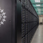
The PGC team is excited to share the Blue Waters supercomputer at the University of Illinois at Urbana-Champaign was granted … Continue reading Blue Waters Extended to Produce Global Topography: high-resolution digital elevation models of the entire Earth

Posts pagination

Previous page Page 1 Page 2 Page 3 Page 4 Next page

Search

Categories

  • All
  • Boot Camp
  • Careers
  • Events
  • News
  • Projects

Archives

Tags

AGU Antarctica Arctic ArcticDEM Awards Careers Conference Conferences Data Data Release DEM Developer DigitalGlobe EarthDEM Elevation EVWHS Full-Time Jobs General Geospatial GIS Graduate Research Assistant Greenland Jobs Maps McMurdo News Newsletter NSF Paul Morin PGC Users Webinar Series REMA remote sensing Satellite Imagery science speakers SETSM SOAC Staff News Student Student Jobs Survey Tasking Tutorial Video Webinar Website

Location

R280 Learning & Environmental Sciences
1954 Buford Avenue
Saint Paul, MN 55108
Find Us

Contact

 612-626-0505
 pgc@umn.edu
 Send Us A Message

Menu

  • About
    • Overview
    • Impact
    • People
    • Find Us
  • Data + Services
    • Overview
    • Maps
    • Satellite
    • Aerial
    • Elevation
    • ArcticDEM
    • REMA
    • Web Applications
    • Request
  • Community
  • Workshops
    • PGC Data
    • Antarctic Cable
  • Guides

Follow Us

NSF LogoThe Polar Geospatial Center (PGC) is a research facility funded by the National Science Foundation.
PGC is a proud part of the University of Minnesota's College of Science and Engineering.

© Polar Geospatial Center. All Rights Reserved. Site by Wooly Mammoth Design.
Polar Geospatial Center
PGC Service Interruption

Important notice from the PGC.

The University of Minnesota is undergoing planned maintenance on its data center from Friday, January 5, 2017 4:00p to Sunday, January 7, 2018 12:00p. PGC services will be unavailable at that time. We apologize for any inconvenience!

PGC SERVICES IMPACTED:
  • Data downloads from HTTP/FTP Servers (public and private)
  • UMN servers hosting PGC data
  • Web mapping applications (e.g. PGC Imagery Viewers) and ArcGIS web services
PGC SERVICES NOT IMPACTED:
  • PGC Website
  • PGC Staff Email
  • ArcticDEM Web Services

 Do Not Show Again
✖

For Students, Faculty, and Staff

  1. One Stop
  2. My U
© 2018 Regents of the University of Minnesota. All rights reserved. The University of Minnesota is an equal opportunity educator and employer. Privacy Statement