
PGC Support Vignette: NSF-PLR #1259167
Overview
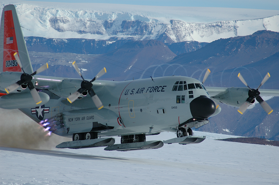
The 109th Airlift Wing is a unit of the New York Air National Guard and provides transport to some of the most remote sites in the Arctic and Antarctic. Flying LC-130 Hercules airlifters with wheel-ski gear, the Wing assists NSF’s polar research programs.
The unit began annual support to NSF in the Antarctic in 1999. Since then, the Wing has completed dozens of missions each season, flying hundreds of researchers and support staff and many tons of cargo across the continent.
Explanation of Support
Data: Custom mapping and processed satellite imagery
Using high-resolution imagery collected by commercial satellites, PGC staff created two series of maps at two different scales, totalling 32 unique maps. The maps were provided to the 109th Airlift Wing as georeferenced PDF files (GeoPDFs) along with the full-resolution orthorectified satellite imagery.
The first series of “Planning Maps” depicts eight 2016-2017 fixed-wing landing sites using imagery collected the previous year. The maps were delivered in advance of current-year flight operations to perform initial landing site assessments.
The second series of eight “Early Season” maps utilized the most recent imagery available over the sites collected during the 2016-17 field season. Each of the two series of eight maps were produced at both 1:10,000 and 1:50,000 scale, providing materials complementary in extent and detail.
With up-to-date maps and imagery corrected for terrain displacement, PGC’s support enabled the 109th Airlift Wing to safely plan and land dozens of missions across the continent.
Impacts & Implications
Logistics: Safe transport of NSF researchers and cargo
Safe flight operations are critical to the success of NSF polar research. Maps and imagery provided by the PGC allows 109th pilots and navigators to evaluate surface conditions at landing sites, identify potential navigational aids or hazards, plot coordinates, and familiarize themselves with the characteristics of the surrounding terrain at each site prior to flying and as the field season commences.
Read more PGC Support Vignettes here. Want your work to be featured in a vignette? Send us a message.