
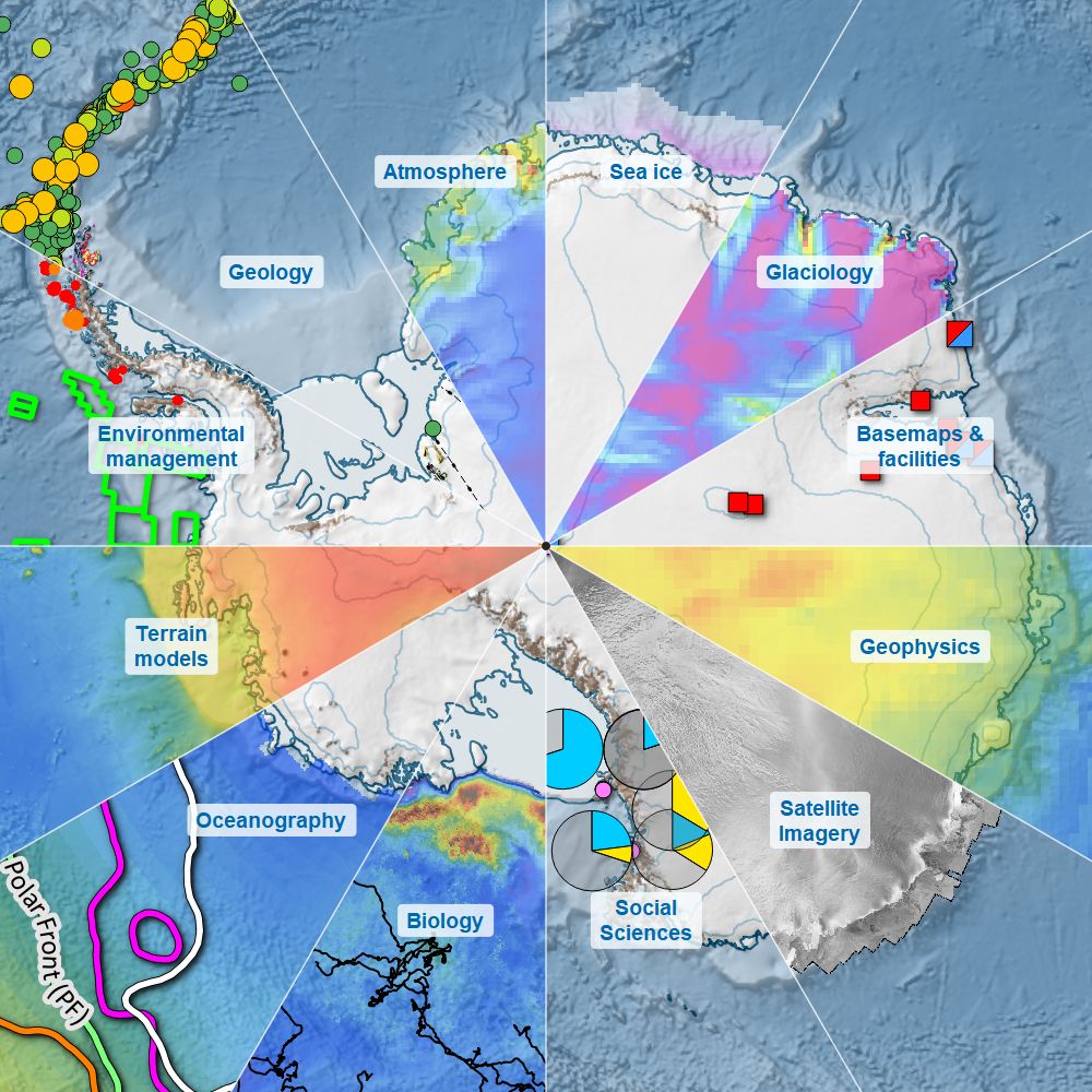
Quantarctica Version 4 Released!
The Polar Geospatial Center (PGC) is excited to share that Quantarctica Version 4 has officially been released! Developed by the Norwegian Polar Institute (NPI) in collaboration with an international editorial team, Quantarctica remains one of the most accessible tools for the polar research community.
This major release expands the package significantly, almost doubling the size of its data collection to support research, education, environmental management, and logistics across the Antarctic continent.
What is Quantarctica?
Quantarctica is a free, open-sourced geospatial data package designed specifically for Antarctic research, education, environmental management, and field operations. It is a collection of Antarctic geographical datasets which works with the free, open-source software QGIS as well as offline, making it essential resource both in institutional labs and remote field camps.
First released publicly in 2013 as a Scientific Committee on Antarctic Research (SCAR) product, Quantarctica brings together high-quality, peer-reviewed spatial datasets from research groups worldwide into a single, standardized, easy-to-use package.
Read more in the Norwegian Polar Institute’s LinkedIn announcement here or visit the project website at https://sites.npolar.no/quantarctica/.
What’s New In Version 4?
Expanded Data Collection: Now features nearly 640 curated geospatial datasets covering Antarctica, subantarctic islands and the Southern Ocean.
Updated Basemaps and Elevation: Includes updated digital elevation models (DEMs) – including PGC’s REMA, satellite imagery, and terrain basemaps for higher precision mapping.
Broad Multidisciplinary Coverage: Packages ready-to-use GIS layers spanning glaciology, geophysics, oceanography, biology, environmental management, and historical mapping.
Where to Access Quantarctica?
DOWNLOAD VERSION 4
The data package (10 GB compressed) is now available through the NPI Data Centre: https://doi.org/10.21334/NPOLAR.2026.1DA42C46
PGC has agreed to mirror the package to speed up the download for North American users via FTP and HTTPS. Use the URLs below for access (no authentication required). For downloading the entire package (10 GB), we recommend using an FTP client.
- FTP: ftp.data.pgc.umn.edu/gis/packages/quantarctica
- HTTPS: https://data.pgc.umn.edu/gis/packages/quantarctica/
How to Cite Quantarctica?
When using Quantarctica Version 4 in your work, please remember to cite both the original source dataset authors and the Quantarctica overall package citation:
Matsuoka, K., Skoglund, A., Wendt, L., Mahagaonkar, A., Tronstad, S., Cajiao, D., Fraser, A., Hills, B., Leihy, R., Liggett, D., Moreau, S., Nakayama, Y., Noël, B., Paxman, G., Poinelli, M., Ritz, C., Ruppel, A., Scheinert, M., Seyboth, E., & Trusel, L. (2026). Quantarctica Version 4: Integrated Geospatial Data Package for Antarctica, the Southern Ocean, and Subantarctic Islands [Dataset]. Norwegian Polar Institute. https://doi.org/10.21334/