

Missed out on the newsletter via email? Sign up here!
PGC People Updates
PGC Hires New Director
 PGC recently hired James (“Jay”) Dickson, as the new Director, effective in September 2023.
Dickson comes to the PGC from the California Institute of Technology in Pasadena where he serves as the manager of the Bruce Murray Laboratory for Planetary Visualization and Caltech Div. of Geology and Planetary Science GIS Lab.
His career is versed in both polar and planetary geospatial data work, solving large problems in remote areas – a great fit for PGC. Dickson has deployed for over eight field seasons in Antarctica, once collecting over 600,000 timelapse images from cameras and integrated with meteorological sensors. Recently, he has led the construction of the largest image ever made: an 8.75-trillion-pixel mosaic of the surface of Mars.
The PGC team looks forward to his start this upcoming fall!
PGC Welcomes New Staff Members


We would like to extend a warm welcome to Kelsey Zimmerman, our newest Geospatial Support Specialist, and Rory Johnson, our newest software engineer. Zimmerman brings a unique background in social science research communications and dissemination, holding a Master’s degree in Creative Writing and Environment and certificate in GIS. Johnson brings nearly 20 years of industry experience as a developer, including 8 years at the University of Minnesota’s health information services.
We’re thrilled to have them join our team!
PGC Includes New Representation on Advisory Committee
The Polar Geospatial Center received several nomination submissions for their Science and Operations Advisory Committee (SOAC). The first phase in the selection process is complete and for the first time new representation on the committee will include members from two new communities. Bonnie Meinke, Engagement Lead at the National Ecological Observatory Network (NEON), is our newest member representing expertise from an NSF Facility. James King, field operations manager at the United States Antarctic Program (USAP), is our newest member representing expertise from the Polar Operations and Logistics community. The PGC and SOAC recognize Meinke and King’s membership add significant value to the committee’s service.
New appointments to replace current committee members rotating off will be forthcoming. Accepted nominees will be notified directly.
PGC Updates + Events
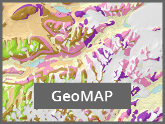
Announcing GeoMAP, a comprehensive pan-Antarctic geological dataset
GeoMAP, Geological Mapping of Antarctica, is a revolutionary intiative launched by the Scientific Committee on Antarctic Research (SCAR) to advance geoscientific exploration in Antarctica by combining geological, geomorphological, and geophysical data into an interactive web map.
PGC’s former Director, Paul Morin, and team provided access to aerial photos, LiDAR, REMA, and other data for GeoMAP construction. GeoMAP seeks to is aimed towards continent-wide perspectives and cross-discipline interrogation that will enhance our understanding of the region’s geological history and help predict future changes.
Learn more about GeoMAP, visit:
https://www.scar.org/ssg/
Access the GeoMAP Download Page
Access GeoMAP Metadata
Access detailed GeoMAP documentation
A GeoMAP web-based explorer can be accessed directly through Antarctic Explorer.
For queries about GeoMAP, please get in touch with the GMNZ Data Manager.
PGC Broader Impacts

We are launching a PGC user community slack! This is a shared space for community members to connect with one another.
Join and connect with the community here.
Feel free to create channels for collaboration, connection, and topics of interest. The space is yours to exchange information and build relationships.
Antarctic Tasking Requests Due July 14, 2023

PGC is working with the National Geospatial-Intelligence Agency (NGA) to coordinate collections of high-resolution commercial satellite imagery from Maxar for the upcoming 2023-24 Antarctic field season.
Please get in touch with your PGC Point of Contact if you have current federal funding and are conducting Antarctic research or providing Antarctic logistics support and would like to submit tasking requests for your area(s) of interest. The deadline for requests for the upcoming Antarctic field season is July 14th, 2023.
If you submitted a request for a previous year and would like to have imagery collected for a future season contact your POC for resubmission.
PGC Antarctic Imagery Mosaic Refresh


Our Antarctic 50 cm panchromatic imagery mosaic refresh this year (2022-23) is now available to Users in our web-based mapping application. PGC’s Antarctic, Arctic and Wo
Here are the major improvements highlighted:
- 370 tiles updated
- ~3,700,000 sq km of updated coverage
- 15,832 Catalog IDs included in the update
- 19,000 cloudy images identified and removed
- Significant coverage was focused on the coast, peninsula, and West Antarctic Ice Sheet (see map)
Access to secured and licensed data layers in PGC’s Imagery Viewers are restricted to current federally-funded polar researchers, federal employees, or subcontractors. New users can request an account here.
PGC verifies all funding sources after you submit a request.
Conference Connections
PGC at the UN

In May, two members of the PGC team headed to New York to participate in the 2023 Session of the United Nations Group of Experts on Geographic Names (UNGEGN). Cole Kelleher and Chris Carter spent five days attending meetings, participating in discussions and connecting experts from around the world.
As part of this session, as the U.S. representative to the SCAR Standing Committee on Antarctic Geographic Information (SCAGI), Kelleher presented a report on SCAR guidelines regarding Antarctic geographic naming, drawn up by SCAGI and published by SCAR, which was enthusiastically accepted and endorsed by the Group of Experts.
For more information, check out our full article here:
https://www.pgc.umn.edu/news/
PGC at Mapping the Arctic in Nuuk, Greenland
 In April, PGC attended the “Mapping the Arctic” conference in Nuuk, Greenland. This unique conference provided opportunities to connect with the international polar community at large – including scientific, civil, and commercial domains.
Two of the many takeaways we want to share with our user community are:
- If you are conducting research in Greenland, utilize Arctic Hub! This is a valuable resource connecting people across sectors to research conducted in Greenland. Be a part of the knowledge circuit and visit Arctichub.gl to learn more and book a meeting.
- The Danish Agency for Data Supply and Infrastructure completed a 4-year, over $10m mapping project of Greenland featuring ArcticDEM, satellite imagery, various data formats (pdf, wms, geotiffs, api, etc.) all freely available here.
